Pick your stops — we check if they actually work
Select which destinations you want to visit and how many nights you have. TripPace treats it as a route to be tested, not a list to be confirmed.
Just pick your stops and let TripPace do the checking.
Every leg tested against realistic Namibia road data
Each driving day is calculated against gravel conditions, actual distances, fuel gaps, gate closing times, and private access requirements. Not Google Maps. Not a blog.
Realistic data from 200+ verified Namibia road segments — gravel-adjusted, sunset-aware.
A plain verdict for every day — no expertise required
Every driving leg gets a verdict. Green means comfortable. Amber means early start advised. Red means most travellers split this drive. No guesswork, no jargon.
Plain language. You see exactly which days are fine and which ones need attention.
Every driving leg between overnight stops gets one of three verdicts — no jargon, no guessing.
A comfortable Namibia driving day with time for stops and sightseeing. No heroics required.
Manageable but needs an early start. Plan fuel stops in advance and aim to arrive before sunset.
Most travellers split this drive. Consider adding an overnight stop to make it work.
Five things that catch
every first-time planner.
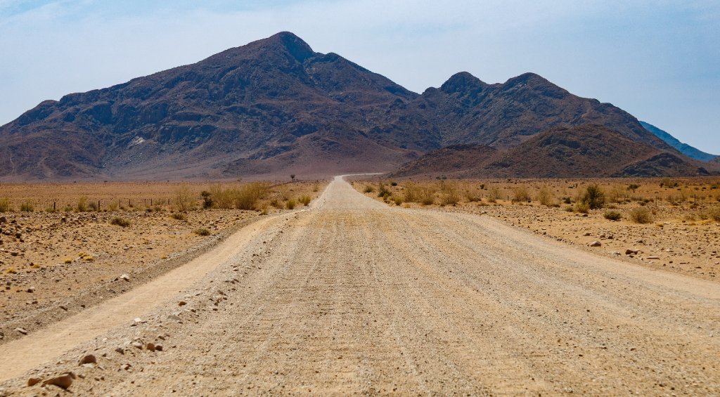
Gravel roads aren't Google roads
80% of Namibia's interesting destinations are on gravel. A 300km day on the map is 5 hours of corrugated gravel in reality. TripPace uses gravel-adjusted speeds throughout.
Fuel gaps are real
Gaps of 300–400km exist on common Namibia routes. Running dry in Kaokoland or the Caprivi isn't an adventure — it's a preventable problem. Every route is checked for fuel availability.
Private land changes everything
Some of Namibia's best destinations are only accessible if you're staying at the lodge. No drive-bys, no exceptions. TripPace flags every one.
No driving after dark
Livestock, wildlife, and unfenced roads make night driving in Namibia genuinely dangerous. Every drive time is calculated assuming daylight hours only.
Your rental agreement restricts which roads you can drive
Most Namibia rental agreements prohibit certain gravel roads or require a 4x4 for specific routes. Your vehicle type determines which destinations are actually accessible.
TripPace checks every one of these — before you leave.
Take your Namibia route from rough idea to something you can actually drive — stop by stop, day by day.
Here's everything the planner gives you:
Is there an app or website for planning a Namibia self-drive road trip?
Yes — TripPace Namibia is a free web-based route planner built specifically for Namibia self-drive trips. Add your stops and it checks realistic gravel-adjusted driving times, fuel gaps, and gate timing, then gives each day a plain verdict: doable, tough, or impractical. Try the free pace check.
What are the best tools for planning a Namibia self-drive trip?
Several tools cover different parts of the trip. TripPace Namibia is built specifically around the part most generic planners get wrong — whether your daily drives are actually realistic on gravel roads, not just whether the stops are plotted on a map. See how it works.
Which Namibia itinerary planners verify park gate timings?
TripPace Namibia factors gate and sunset timing into every route it checks, flagging any day where your last stop is cutting it close to a park’s closing time. Check your Etosha day.
What are the safest ways to plan a Namibia self-drive route?
Namibia’s real self-drive risk is the roads, not crime — mainly gravel rollovers from over-speeding and night driving. Planning safely means checking realistic drive times and daylight, not just distance. Read the full breakdown in Is Namibia Safe for a Self-Drive Adventure?.

We use a cookie for anonymous analytics (Google Analytics) to see how the site is used and make it better. It only loads if you accept. You can decline and the site works exactly the same. See our privacy policy.